 Sale!
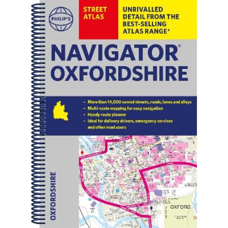
Sale! The only county Street Atlas with all the named streets of Oxfordshire and perfect back-up for emergency services, delivery drivers, visitors and locals.With more than 11,000 named streets, roads, lanes and alleys, this is the essential map book for reside
The only county Street Atlas with all the named streets of Oxfordshire and perfect back-up for emergency services, delivery drivers, visitors and locals.
With more than 11,000 named streets, roads, lanes and alleys, this is the essential map book for residents and visitors – especially if you’re in a hurry
Includes all the streets in ABINGDON-ON-THAMES, BANBURY, BICESTER, DIDCOT, HENLEY-ON-THAMES, KIDLINGTON, OXFORD, THAME, WITNEY, Adderbury, Benson, Burford, Carterton, Caversham, Chalgrove, Charlbury, Chinnor, Chipping Norton, Cholsey, Cowley, Cumnor, Eynsham, Faringdon, Goring, Grove, Headington, Highworth, Kennington, Lechlade-on-Thames, Middleton Cheney, Pangbourne, Sonning Common, Stokenchurch, Wallingford, Wantage, Wargrave, Watlington, Wheatley, Woodstock, Wootton.
– New completely revised edition in practical spiral-bound format
– Street maps show car parks, schools, hospitals and many other places of interest, including off the beaten track
– Information on the ZEZ and other zones
– 2-page practical route-planning section showing all A and B roads
– Super-clear mapping
– Easy-to-use index
– Scales: 3 inches to 1 mile (1:18,000). Oxford: 7 inches to 1 mile (1:9,000).
Other information on the maps includes postcode boundaries, car parks, railway and bus stations, post offices, schools, colleges, hospitals, police and fire stations, places of worship, leisure centres, footpaths and bridleways, camping and caravan sites, golf courses, and many other places of interest.
Philip’s has been at the forefront of creating maps and atlases since 1834. Whether a local street map or a fact-packed World Atlas, we use the most up-to-date technology, expertise and our global network to ensure our customers have all the information they need.
Cost - $25
Free Shipping We offer free shipping on orders over $30. Please check the free - shipping eligibility at checkout.
Delivery Time It usually takes [3-5] business days for standard shipping. Please note that this is an estimated time frame and may be affected by local holidays, and unforeseen circumstances.


Reviews
There are no reviews yet.